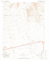
1969 Map of Moapa Peak SE
USGS Topo · Published 1973About this map
The Old Spanish Trail cuts across this high desert landscape, tracing a historic path through the arid expanse of Mormon Mesa. Surveyed in the late 1960s, the map illustrates the intersection of ancient transit routes and modern infrastructure, most notably where the interstate corridor meets the East Mesa Interchange. Small settlements and points of interest such as Dean, Bush, and Atoll are situated near the highway, reflecting the sparse but strategic human presence in this region of Clark County.
Find a feature on this map
15 named features on this map. Tap any name to fly to it.
Don’t see what you’re looking for? This feature index may not catch every label — zoom into the map to look around manually.
Map Details
Editions of this 1969 Moapa Peak SE Map
2 editions found
Other maps of this area

1886 · Saint Thomas
USGS Topo · 1:250,000

1893 · Saint Thomas
USGS Topo · 1:250,000

1954 · Las Vegas
USGS Topo · 1:250,000

1957 · Las Vegas
USGS Topo · 1:250,000

1957 · Mesquite
USGS Topo · 1:62,500

1958 · Virgin Peak
USGS Topo · 1:62,500

1958 · Overton
USGS Topo · 1:62,500

1959 · Las Vegas
USGS Topo · 1:250,000

1962 · Las Vegas
USGS Topo · 1:250,000
1969 · Moapa Peak
USGS Topo · 1:24,000