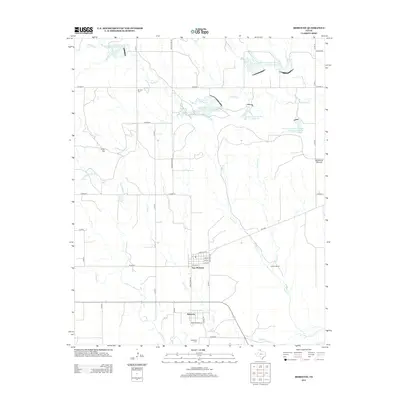
2012 Map of Mobeetie
USGS Topo · Published 2012About this map
Mobeetie and New Mobeetie are the primary settlements shown here, representing the enduring heart of Wheeler County in the early 21st century. The landscape is defined by the drainage systems of Sweetwater Cr, Gageby Cr, and Adobe Cr, which are supplemented by several modern water management features including Soil Conservation Service Site 17 Reservoir. These reservoirs point to the essential role of water conservation in the Texas Panhandle's agricultural environment.
Find a feature on this map
42 named features on this map. Tap any name to fly to it.
Don’t see what you’re looking for? This feature index may not catch every label — zoom into the map to look around manually.
Map Details
Editions of this 2012 Mobeetie Map
This is the sole edition of this map. No revisions or reprints were ever made.
Other maps of this area

1954 · Amarillo
USGS Topo · 1:250,000

1958 · Amarillo
USGS Topo · 1:250,000

1962 · Pond Creek
USGS Topo · 1:24,000

1962 · Wheeler
USGS Topo · 1:24,000

1962 · Spring Creek
USGS Topo · 1:24,000

1963 · Briscoe
USGS Topo · 1:24,000

1963 · Mobeetie
USGS Topo · 1:24,000

1967 · Dads Creek
USGS Topo · 1:24,000

1967 · Young Ranch
USGS Topo · 1:24,000

1967 · Tody School
USGS Topo · 1:24,000