
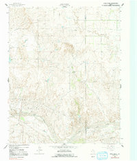
1962 Map of Pond Creek
USGS Topo · Published 1965About this map
The North Fork Red River carves a deep valley through the high plains of the Texas Panhandle in this early 1960s survey. The landscape is defined by the dramatic drainage systems of Pond Creek and Huseby Creek, which feed into the primary river valley from the north. Settlement is sparse, represented by ranching operations like the Huseby Ranch and Harney Ranch, reflecting the region's enduring cattle-ranching economy. In the southern portion of the quadrangle, the Fort Worth and Denver railroad runs parallel to the river, providing a vital transportation link through this arid terrain. Topographical details such as the steep descent into Devils Gulch and the course of Cantonment Creek reveal the complex erosion patterns typical of the Rolling Plains, where water remains the primary architect of the land.
Find a feature on this map
10 named features on this map. Tap any name to fly to it.
Don’t see what you’re looking for? This feature index may not catch every label — zoom into the map to look around manually.
Map Details
Editions of this 1962 Pond Creek Map
2 editions found
Other maps of this area

1954 · Amarillo
USGS Topo · 1:250,000

1958 · Amarillo
USGS Topo · 1:250,000

1962 · Hudgens Ranch
USGS Topo · 1:24,000

1962 · Back
USGS Topo · 1:24,000

1962 · Spring Creek
USGS Topo · 1:24,000

1962 · Pakan
USGS Topo · 1:24,000

1962 · Pond Creek NW
USGS Topo · 1:24,000

1963 · Mobeetie
USGS Topo · 1:24,000

1966 · Laketon
USGS Topo · 1:24,000

1967 · Tody School
USGS Topo · 1:24,000