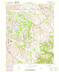
1952 Map of Moberly
USGS Topo · Published 1979About this map
Lexington Blue Grass Army Depot and the related Blue Grass Activity dominate the central landscape of this Madison County map, illustrating the significant military and logistical footprint in the region during the mid-20th century. The topography is defined by the winding course of Muddy Creek, which flows past established rural settlements such as Moberly, Elliston, and Waco. The 1970s updates reveal the expansion of woodland and the maturation of these sites, while the earlier 1952 data preserves a network of local community landmarks. Numerous institutions serve these communities, including Concord School, Speedwell School, and Goodloe Chapel. Further south, the Central Kentucky Wildlife Management Area marks a shift toward conservation and public land use along Drowning Creek, contrasting with the more densely settled areas near Richmond and Kingston to the west.
Find a feature on this map
34 named features on this map. Tap any name to fly to it.
Don’t see what you’re looking for? This feature index may not catch every label — zoom into the map to look around manually.
Map Details
Editions of this 1952 Moberly Map
2 editions found
Other maps of this area

1892 · Richmond
USGS Topo · 1:125,000

1897 · Richmond
USGS Topo · 1:125,000

1952 · Alcorn
USGS Topo · 1:24,000

1952 · Berea
USGS Topo · 1:24,000

1952 · Union City
USGS Topo · 1:24,000

1952 · Palmer
USGS Topo · 1:24,000

1952 · Richmond North
USGS Topo · 1:24,000

1952 · Bighill
USGS Topo · 1:24,000

1952 · Panola
USGS Topo · 1:24,000

1952 · Moberly
USGS Topo · 1:24,000