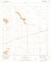
1973 Map of Mobile
USGS Topo · Published 1976About this map
Mobile serves as the primary outpost in this arid landscape, situated along the Maricopa Southern Pacific Road which bisects the quadrangle. The map captures a transitional geography where Rainbow Valley and Mobile Valley meet, shaped by intermittent drainage systems like Waterman Wash and its West Prong. The presence of the Gila and Salt River Meridian provides a critical surveying benchmark for Maricopa County, while the path of the Butterfield Stage Route traces the historical transportation corridor north of the modern rail line. Scattered water sources, including Negro Flat Tank and Middle Tank, indicate the essential infrastructure for ranching or travel in the shadow of Espanto Mtn. A small Cem near the settlement of Mobile offers a specific point of interest for genealogists tracking early desert inhabitants.
Find a feature on this map
17 named features on this map. Tap any name to fly to it.
Don’t see what you’re looking for? This feature index may not catch every label — zoom into the map to look around manually.
Map Details
Editions of this 1973 Mobile Map
2 editions found
Other maps of this area

1913 · Maricopa
USGS Topo · 1:62,500

1915 · Maricopa
USGS Topo · 1:62,500

1946 · Antelope Peak
USGS Topo · 1:62,500

1948 · Antelope Peak
USGS Topo · 1:62,500

1951 · Estrella
USGS Topo · 1:62,500

1951 · Mobile
USGS Topo · 1:62,500

1952 · Montezuma Peak
USGS Topo · 1:24,000

1952 · Enid
USGS Topo · 1:24,000
1952 · Maricopa
USGS Topo · 1:62,500

1953 · Ajo
USGS Topo · 1:250,000