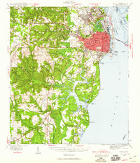
1940 Map of Mobile
USGS Topo · Published 1959About this map
The Mobile River delta and the industrial waterfront of the Gulf Coast define this era of Alabama's history, showing the city's growth just before the mid-century boom. The urban core is anchored by Magnolia Cemetery and prominent educational institutions like Murphy High Sch and Bishop Toolen High Sch. To the north, the rail-dependent suburbs of Whistler and Prichard follow the Gulf Mobile and Ohio tracks, while the eastern shoreline reveals the maritime infrastructure of the Alabama State Docks RR and the Cochrane Bridge crossing toward Blakeley Island.
Find a feature on this map
100 named features on this map. Tap any name to fly to it.
Don’t see what you’re looking for? This feature index may not catch every label — zoom into the map to look around manually.
Map Details
Editions of this 1940 Mobile Map
5 editions found
Other maps of this area

1921 · Grand Bay
USGS Topo · 1:62,500

1921 · Point Clear
USGS Topo · 1:62,500

1921 · Fairhope
USGS Topo · 1:62,500

1921 · Delchamps
USGS Topo · 1:62,500

1922 · Mobile
USGS Topo · 1:62,500

1939 · Daphne
USGS Topo · 1:31,680

1940 · Hollingers Island
USGS Topo · 1:31,680

1940 · Mobile
USGS Topo · 1:31,680

1940 · Mobile
USGS Topo · 1:62,500

1941 · Chickasaw
USGS Topo · 1:31,680