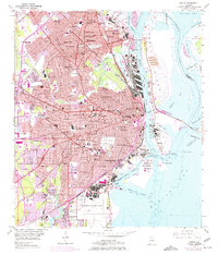
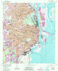
1953 Map of Mobile
USGS Topo · Published 1975About this map
Mobile serves as the focal point of this coastal survey, illustrating the city's complex urban fabric and industrial waterfront at the height of the mid-20th century. The transition from the historic core, featuring landmarks like Barton Academy and Magnolia Cemetery, to the southern expanse of Brookley Air Force Base reflects the significant impact of defense and logistics on the local economy. The mapping reveals a dense network of neighborhoods like Toulminville, Crichton, and Prichard, each served by an array of educational institutions including the University Military Sch and Dunbar High Sch.
Find a feature on this map
121 named features on this map. Tap any name to fly to it.
Don’t see what you’re looking for? This feature index may not catch every label — zoom into the map to look around manually.
Map Details
Editions of this 1953 Mobile Map
5 editions found
Other maps of this area

1921 · Fairhope
USGS Topo · 1:62,500

1922 · Mobile
USGS Topo · 1:62,500

1939 · Daphne
USGS Topo · 1:31,680

1940 · Hollingers Island
USGS Topo · 1:31,680

1940 · Mobile
USGS Topo · 1:31,680

1940 · Mobile
USGS Topo · 1:62,500

1941 · Chickasaw
USGS Topo · 1:31,680

1941 · Daphne
USGS Topo · 1:31,680

1941 · Blakeley
USGS Topo · 1:31,680

1941 · Bay Minette
USGS Topo · 1:62,500