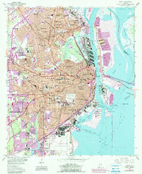
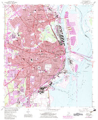
1953 Map of Mobile
USGS Topo · Published 1990About this map
Mobile anchors this 1953 survey, which reveals the complex urban and industrial geography of the Alabama Gulf Coast following the mid-century. The riverfront is dominated by the Mobile River and the Industrial Canal, where extensive rail networks like the Gulf Mobile & Ohio RR and Southern RR converge to support the maritime economy. The map provides an exceptionally detailed record of civic life, documenting dozens of neighborhood schools and institutions, from the University Military Sch and McGill Institute to the sprawling grounds of Magnolia Cemetery. Beyond the city center, the expansion into areas like Toulminville, Crichton, and Prichard is evident, while the coastal edge is defined by USS Battleship Alabama Memorial Park and the vital crossings of the Cochrane Bridge and Bankhead Tunnel.
Find a feature on this map
85 named features on this map. Tap any name to fly to it.
Don’t see what you’re looking for? This feature index may not catch every label — zoom into the map to look around manually.
Map Details
Editions of this 1953 Mobile Map
5 editions found
Other maps of this area

1921 · Fairhope
USGS Topo · 1:62,500

1922 · Mobile
USGS Topo · 1:62,500

1939 · Daphne
USGS Topo · 1:31,680

1940 · Hollingers Island
USGS Topo · 1:31,680

1940 · Mobile
USGS Topo · 1:31,680

1940 · Mobile
USGS Topo · 1:62,500

1941 · Chickasaw
USGS Topo · 1:31,680

1941 · Daphne
USGS Topo · 1:31,680

1941 · Blakeley
USGS Topo · 1:31,680

1941 · Bay Minette
USGS Topo · 1:62,500