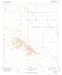
1973 Map of Mobile NW
USGS Topo · Published 1977About this map
Rainbow Valley defines this arid landscape of central Arizona, showing a pattern of mid-1970s land development and infrastructure. The northern portion of the map is dominated by a systematic grid of survey lines and thoroughfares, including Chandler Heights Road and Riggs Road. This organized grid contrasts sharply with the southern terrain, where relief is more pronounced and water management is critical to the local geography.
Find a feature on this map
14 named features on this map. Tap any name to fly to it.
Don’t see what you’re looking for? This feature index may not catch every label — zoom into the map to look around manually.
Map Details
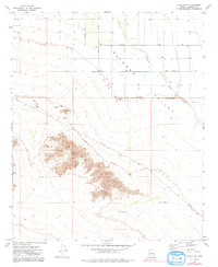
Editions of this 1973 Mobile NW Map
2 editions found
Other maps of this area

1946 · Avondale
USGS Topo · 1:62,500

1948 · Cashion
USGS Topo · 1:62,500

1951 · Mobile
USGS Topo · 1:62,500

1951 · Cotton Center
USGS Topo · 1:62,500

1954 · Phoenix
USGS Topo · 1:250,000

1957 · Phoenix
USGS Topo · 1:250,000

1957 · Avondale SW
USGS Topo · 1:24,000
1957 · Avondale SE
USGS Topo · 1:24,000

1958 · Phoenix
USGS Topo · 1:250,000

1958 · Buckeye
USGS Topo · 1:24,000