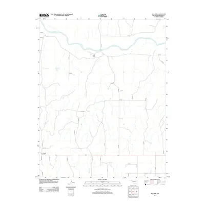
2012 Map of Mocane
USGS Topo · Published 2012About this map
Mocane sits in the High Plains of the Oklahoma Panhandle, serving as a focal point for this rural landscape in Beaver County. The terrain is defined by the winding course of the Cimarron River which carves through the northern portion of the map, creating a distinct riparian break in the otherwise steady grid of section roads. This area reflects the agrarian and aviation history of the region, featuring the Judy Ranch Airport and water management infrastructure such as the Xit Number 11 Reservoir.
Find a feature on this map
38 named features on this map. Tap any name to fly to it.
Don’t see what you’re looking for? This feature index may not catch every label — zoom into the map to look around manually.
Map Details
Editions of this 2012 Mocane Map
This is the sole edition of this map. No revisions or reprints were ever made.
Other maps of this area

1892 · Meade
USGS Topo · 1:125,000

1954 · Perryton
USGS Topo · 1:250,000

1955 · Dodge City
USGS Topo · 1:250,000

1958 · Perryton
USGS Topo · 1:250,000

1958 · Dodge City
USGS Topo · 1:250,000

1959 · Dodge City
USGS Topo · 1:250,000

1962 · Irish Flats SE
USGS Topo · 1:24,000

1963 · Irish Flats
USGS Topo · 1:24,000

1970 · Knowles
USGS Topo · 1:24,000

1970 · Gate NW
USGS Topo · 1:24,000