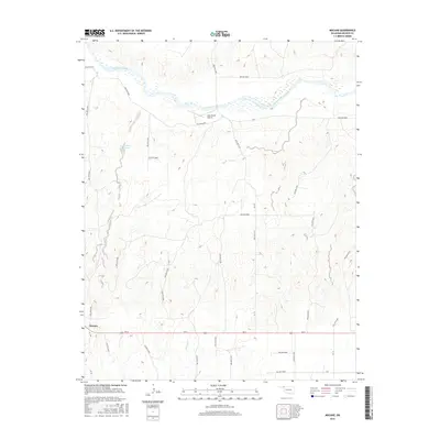
2016 Map of Mocane
USGS Topo · Published 2016About this map
The Cimarron River winds through this High Plains landscape in Beaver County, defining the northern geography of the Oklahoma Panhandle. The small community of Mocane sits in the southwestern corner along Ew 8, serving as a local anchor in an area characterized by deep drainage systems and ranching infrastructure. Among these water-carved features are numerous named hollows, including Hollow E0013 and Hollow N1510, which dictate the local topography and road placement. Evidence of private aviation and water management appears through the Judy Ranch Airport and the Xit Number 11 Reservoir, reflecting the practical adaptations required for life in this arid, open region. The map captures a transition between the river's riparian corridor and the expansive uplands marked by seasonal drainages like Spring Cr.
Find a feature on this map
37 named features on this map. Tap any name to fly to it.
Don’t see what you’re looking for? This feature index may not catch every label — zoom into the map to look around manually.
Map Details
Editions of this 2016 Mocane Map
This is the sole edition of this map. No revisions or reprints were ever made.
Other maps of this area

1892 · Meade
USGS Topo · 1:125,000

1954 · Perryton
USGS Topo · 1:250,000

1955 · Dodge City
USGS Topo · 1:250,000

1958 · Perryton
USGS Topo · 1:250,000

1958 · Dodge City
USGS Topo · 1:250,000

1959 · Dodge City
USGS Topo · 1:250,000

1962 · Irish Flats SE
USGS Topo · 1:24,000

1963 · Irish Flats
USGS Topo · 1:24,000

1970 · Knowles
USGS Topo · 1:24,000

1970 · Gate NW
USGS Topo · 1:24,000