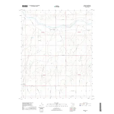
2018 Map of Mocane
USGS Topo · Published 2018About this map
The Cimarron River winds through this section of the Oklahoma Panhandle, carving a wide valley defined by a dense network of drainage features like Hollow E0015 and Hollow D1469. This landscape is primarily agricultural and rural, centered around the small settlement of Mocane in the southwest. The presence of the Judy Ranch Airport and various reservoirs, such as Xit Number 11 Reservoir, indicates the importance of managed water resources and private aviation in this sparsely populated cattle and farming region. The map reveals the classic township and range grid system, with roads like Ew 8 and Ew 9 providing the primary structure for movement across the plains. Large-scale topographic details showcase the subtle but complex erosion patterns leading toward Spring Cr and the river basin, which dominated the local geography in 2018.
Find a feature on this map
37 named features on this map. Tap any name to fly to it.
Don’t see what you’re looking for? This feature index may not catch every label — zoom into the map to look around manually.
Map Details
Editions of this 2018 Mocane Map
This is the sole edition of this map. No revisions or reprints were ever made.
Other maps of this area

1892 · Meade
USGS Topo · 1:125,000

1954 · Perryton
USGS Topo · 1:250,000

1955 · Dodge City
USGS Topo · 1:250,000

1958 · Perryton
USGS Topo · 1:250,000

1958 · Dodge City
USGS Topo · 1:250,000

1959 · Dodge City
USGS Topo · 1:250,000

1962 · Irish Flats SE
USGS Topo · 1:24,000

1963 · Irish Flats
USGS Topo · 1:24,000

1970 · Knowles
USGS Topo · 1:24,000

1970 · Gate NW
USGS Topo · 1:24,000