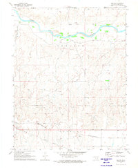
1970 Map of Mocane
USGS Topo · Published 1973About this map
The Cimarron River winds through the northern portion of this High Plains landscape, which was documented by the Geological Survey during a period of significant industrial activity in the Oklahoma Panhandle. The small community of Mocane sits in the southwestern quadrant, serving as a landmark along the Missouri-Kansas-Texas railroad line that cuts across the southern terrain. This transportation corridor is mirrored by an extensive network of pipelines and numerous extractive sites, including a dense concentration of Gas Wells and an Oil Well, illustrating the region's mid-century energy production.
Find a feature on this map
13 named features on this map. Tap any name to fly to it.
Don’t see what you’re looking for? This feature index may not catch every label — zoom into the map to look around manually.
Map Details
Editions of this 1970 Mocane Map
This is the sole edition of this map. No revisions or reprints were ever made.
Other maps of this area

1892 · Meade
USGS Topo · 1:125,000

1954 · Perryton
USGS Topo · 1:250,000

1955 · Dodge City
USGS Topo · 1:250,000

1958 · Perryton
USGS Topo · 1:250,000

1958 · Dodge City
USGS Topo · 1:250,000

1959 · Dodge City
USGS Topo · 1:250,000

1962 · Irish Flats SE
USGS Topo · 1:24,000

1963 · Irish Flats
USGS Topo · 1:24,000

1970 · Knowles
USGS Topo · 1:24,000

1970 · Gate NW
USGS Topo · 1:24,000