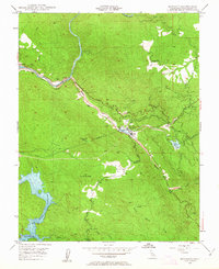
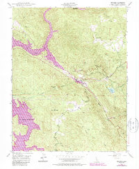
1948 Map of Moccasin
USGS Topo · Published 1963About this map
Gold-bearing hills and hydraulic engineering intersect near Moccasin in the late 1940s. The landscape is defined by the massive infrastructure of the Hetch Hetchy Aqueduct and the waters of the Don Pedro Reservoir, which dominate the western sections of the quadrangle. Significant industrial history is evident through the presence of the Inclined Railroad and the Moccasin Res, components of the regional water and power system.
Find a feature on this map
34 named features on this map. Tap any name to fly to it.
Don’t see what you’re looking for? This feature index may not catch every label — zoom into the map to look around manually.
Map Details
Editions of this 1948 Moccasin Map
5 editions found
Other maps of this area

1893 · Sonora
USGS Topo · 1:125,000

1896 · Sonora
USGS Topo · 1:125,000

1897 · Sonora
USGS Topo · 1:125,000

1898 · Sonora
USGS Topo · 1:125,000

1915 · La Grange
USGS Topo · 1:24,000

1919 · La Grange
USGS Topo · 1:31,680

1944 · Merced Falls
USGS Topo · 1:62,500

1947 · San Jose
USGS Topo · 1:250,000

1947 · Coulterville
USGS Topo · 1:62,500
1947 · Chinese Camp
USGS Topo · 1:24,000