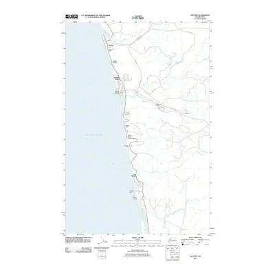
2011 Map of Moclips
USGS Topo · Published 2011About this map
Moclips and its neighboring seaside hamlets anchor this coastal landscape where the Olympic Peninsula meets the Pacific Ocean. This 2011 survey details a strip of shoreline development characterized by seasonal retreats and residential clusters, including Pacific Beach and the elevated Highland Heights. The map reflects a dual economy of tourism and timber, with the community of Aloha situated inland along Ocean Beach Rd and Beaver Creek. A complex network of logging and service roads like Road B-1000 and Powerline Rd penetrates the wooded interior between the Moclips River and the Copalis River. Distinctive coastal landmarks such as Yellow Bluff and Copalis Rock mark the edge of the continent, while the Moclips Post Office remains a central point for local residents and genealogy researchers tracing family ties to these Grays Harbor County beaches.
Find a feature on this map
34 named features on this map. Tap any name to fly to it.
Don’t see what you’re looking for? This feature index may not catch every label — zoom into the map to look around manually.
Map Details
Editions of this 2011 Moclips Map
This is the sole edition of this map. No revisions or reprints were ever made.
Other maps of this area

1938 · Moclips
USGS Topo · 1:62,500

1941 · Moclips
USGS Topo · 1:62,500

1943 · Copalis Beach
USGS Topo · 1:250,000

1951 · Copalis Beach
USGS Topo · 1:250,000

1955 · Taholah
USGS Topo · 1:62,500

1955 · Macafee Hill
USGS Topo · 1:62,500

1955 · Carlisle
USGS Topo · 1:24,000

1955 · Copalis Beach
USGS Topo · 1:24,000
1955 · Moclips
USGS Topo · 1:24,000

1956 · Copalis Crossing
USGS Topo · 1:24,000