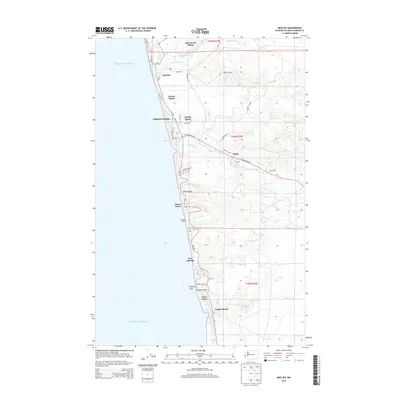
2014 Map of Moclips
USGS Topo · Published 2014About this map
The Pacific Ocean coastline of Grays Harbor County defines this landscape, where a string of beach communities follow the path of Wa-109. In the north, the Moclips River meets the sea near Moclips and the Qui-nai-elt Village, while the southern reaches are shaped by the meandering Copalis River and its entry point near Copalis Beach. The interior reveals a geography of timber and transport, marked by the old route of Railroad Ave and timber-access paths like Road B-Line. Settlements such as Aloha and Stearnsville sit inland from the coastal bluffs, including Yellow Bluff. Between the residential clusters at Pacific Beach and Ocean Grove, the terrain is carved by numerous coastal drainages like Joe Creek, Beaver Cr, and Boone Cr.
Find a feature on this map
49 named features on this map. Tap any name to fly to it.
Don’t see what you’re looking for? This feature index may not catch every label — zoom into the map to look around manually.
Map Details
Editions of this 2014 Moclips Map
This is the sole edition of this map. No revisions or reprints were ever made.
Other maps of this area

1938 · Moclips
USGS Topo · 1:62,500

1941 · Moclips
USGS Topo · 1:62,500

1943 · Copalis Beach
USGS Topo · 1:250,000

1951 · Copalis Beach
USGS Topo · 1:250,000

1955 · Taholah
USGS Topo · 1:62,500

1955 · Macafee Hill
USGS Topo · 1:62,500

1955 · Carlisle
USGS Topo · 1:24,000

1955 · Copalis Beach
USGS Topo · 1:24,000
1955 · Moclips
USGS Topo · 1:24,000

1956 · Copalis Crossing
USGS Topo · 1:24,000