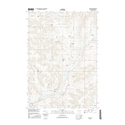
2015 Map of Modena
USGS Topo · Published 2015About this map
The Buffalo River carves a winding path through the heart of Buffalo County in this 2015 survey, defining a landscape of deeply etched bluffs and broad agricultural valleys. The small settlement of Modena sits at the junction of Tamarack Cr and Little Tamarack Cr, serving as a central point for the surrounding rural homesteads. This geography is characterized by numerous family-named landmarks and drainages, including Larson Valley, Hanson Valley, and the prominent Erickson Bluff in the north. The map documents the persistent rural character of the region, where legacy settlements like Tell and Praag remain connected by a network of county roads. For genealogists and local historians, the proximity of Modena Cem to the town site and the variety of named valleys such as German Valley and Kissel Valley offer specific points of interest for tracing family landholdings in this part of Wisconsin.
Find a feature on this map
60 named features on this map. Tap any name to fly to it.
Don’t see what you’re looking for? This feature index may not catch every label — zoom into the map to look around manually.
Map Details
Editions of this 2015 Modena Map
This is the sole edition of this map. No revisions or reprints were ever made.
Other maps of this area

1929 · Durand
USGS Topo · 1:62,500

1932 · Gilmanton
USGS Topo · 1:62,500

1932 · Durand
USGS Topo · 1:62,500

1932 · Alma
USGS Topo · 1:62,500

1932 · Mondovi
USGS Topo · 1:62,500

1950 · Alma
USGS Topo · 1:62,500

1953 · Eau Claire
USGS Topo · 1:250,000

1958 · Eau Claire
USGS Topo · 1:250,000

1964 · Eau Claire
USGS Topo · 1:250,000
1972 · Tarrant
USGS Topo · 1:24,000