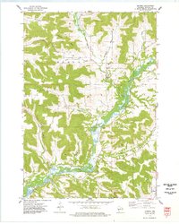
1974 Map of Modena
USGS Topo · Published 1977About this map
The Buffalo River winds through a landscape defined by steep coulees and family-named valleys in this mid-1970s survey of Buffalo County. The small settlement of Modena serves as a central point of interest, featuring the St Paul Ch and the Modena Cem, which anchor the local community history of the area. The surrounding terrain is marked by prominent ridges such as Erickson Bluff and Pine Bluff, separating fertile drainage basins like Larson Valley and German Valley.
Find a feature on this map
25 named features on this map. Tap any name to fly to it.
Don’t see what you’re looking for? This feature index may not catch every label — zoom into the map to look around manually.
Map Details
Editions of this 1974 Modena Map
This is the sole edition of this map. No revisions or reprints were ever made.
Other maps of this area

1929 · Durand
USGS Topo · 1:62,500

1932 · Gilmanton
USGS Topo · 1:62,500

1932 · Durand
USGS Topo · 1:62,500

1932 · Alma
USGS Topo · 1:62,500

1932 · Mondovi
USGS Topo · 1:62,500

1950 · Alma
USGS Topo · 1:62,500

1953 · Eau Claire
USGS Topo · 1:250,000

1958 · Eau Claire
USGS Topo · 1:250,000

1964 · Eau Claire
USGS Topo · 1:250,000
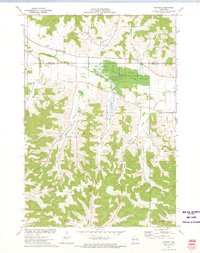
1972 · Tarrant
USGS Topo · 1:24,000