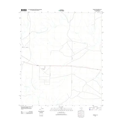
2012 Map of Mofeta
USGS Topo · Published 2012About this map
Mofeta serves as the central point for this high-desert landscape in Terrell County, where human infrastructure follows the seasonal drainage patterns of the Trans-Pecos. The Terrell County Airport dominates the immediate vicinity, its runways and access via Airport Rd and Valley View Rd reflecting the region's reliance on aviation in a landscape defined by isolation. Transport corridors like the primary east-west highway and ranch roads such as Rose Rd link remote outposts like Rose Ranch to the wider county. The hydrology of the area is characterized by intermittent flows, with Buck Cr and Sanderson Cr carving paths through the terrain. These ephemeral watercourses and the sparse network of secondary routes like Dyer Rd and Odom Rd illustrate the strategic management of a semi-arid environment in the early twenty-first century.
Find a feature on this map
10 named features on this map. Tap any name to fly to it.
Don’t see what you’re looking for? This feature index may not catch every label — zoom into the map to look around manually.
Map Details
Editions of this 2012 Mofeta Map
This is the sole edition of this map. No revisions or reprints were ever made.
Other maps of this area

1918 · Dryden Crossing
USGS Topo · 1:62,500

1918 · Indian Wells
USGS Topo · 1:62,500

1928 · Sanderson
USGS Topo · 1:125,000

1954 · Fort Stockton
USGS Topo · 1:250,000

1958 · Fort Stockton
USGS Topo · 1:250,000

1959 · Emory Peak
USGS Topo · 1:250,000

1965 · Emory Peak
USGS Topo · 1:250,000

1968 · Dryden
USGS Topo · 1:24,000

1969 · Sanderson SE
USGS Topo · 1:24,000

1969 · Mofeta
USGS Topo · 1:24,000