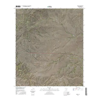
2016 Map of Mofeta
USGS Topo · Published 2016About this map
Mofeta sits at the heart of this Terrell County landscape, where the high desert plateau is carved by deep drainages and isolated roadways. The map illustrates a transitional environment where the flat expanse of the Terrell County Airport meets the complex topography of Sanderson Canyon and McClain Canyon. The local transport network, defined by routes like Valley View Rd and Odom Rd, traces the contours of the land, while seasonal watercourses such as Buck Cr and Sanderson Cr have shaped the deep canyon systems that dominate the southern and eastern portions of the quadrangle. This 2016 survey documents the infrastructure of a remote Texas ranching and aviation hub, showing the precise relationship between modern paved access and the ancient erosional features of the Trans-Pecos region.
Find a feature on this map
12 named features on this map. Tap any name to fly to it.
Don’t see what you’re looking for? This feature index may not catch every label — zoom into the map to look around manually.
Map Details
Editions of this 2016 Mofeta Map
This is the sole edition of this map. No revisions or reprints were ever made.
Other maps of this area

1918 · Dryden Crossing
USGS Topo · 1:62,500

1918 · Indian Wells
USGS Topo · 1:62,500

1928 · Sanderson
USGS Topo · 1:125,000

1954 · Fort Stockton
USGS Topo · 1:250,000

1958 · Fort Stockton
USGS Topo · 1:250,000

1959 · Emory Peak
USGS Topo · 1:250,000

1965 · Emory Peak
USGS Topo · 1:250,000

1968 · Dryden
USGS Topo · 1:24,000

1969 · Sanderson SE
USGS Topo · 1:24,000

1969 · Mofeta
USGS Topo · 1:24,000