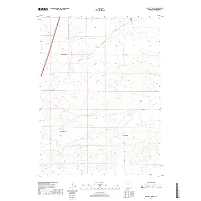
2017 Map of Moffett Ranch
USGS Topo · Published 2017About this map
Moffett Ranch and the surrounding high plains of Laramie County define this 2017 landscape, where the traditional cattle ranching economy persists alongside modern transportation corridors. The terrain is structured by the winding paths of N Bear Cr and Little Bear Cr, which dictate the placement of local thoroughfares like Vowers Rd and Wilkerson Rd. A notable intersection of aviation and ranching is evident at the Vowers Ranch Airport, reflecting the logistical needs of expansive Western landholdings. To the west, the presence of the I-25 Svc Rd marks the proximity of the interstate corridor, contrasting the interior network of county roads like Co Rd 238 that serve the homesteads and vast range lands of this Wyoming territory.
Find a feature on this map
16 named features on this map. Tap any name to fly to it.
Don’t see what you’re looking for? This feature index may not catch every label — zoom into the map to look around manually.
Map Details
Editions of this 2017 Moffett Ranch Map
This is the sole edition of this map. No revisions or reprints were ever made.
Other maps of this area

1911 · Cheyenne
USGS Topo · 1:125,000

1914 · Cheyenne
USGS Topo · 1:125,000

1954 · Cheyenne
USGS Topo · 1:250,000

1958 · Cheyenne
USGS Topo · 1:250,000

1962 · Moffett Ranch
USGS Topo · 1:24,000

1962 · Lewis Ranch
USGS Topo · 1:24,000

1962 · Bristol Ridge
USGS Topo · 1:24,000
1962 · Nimmo Ranch
USGS Topo · 1:24,000

1962 · Bristol Ridge NE
USGS Topo · 1:24,000
1962 · Whitcomb Hill
USGS Topo · 1:24,000