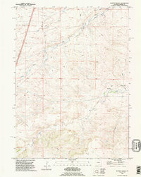
1990 Map of Moffett Ranch
USGS Topo · Published 1995About this map
Moffett Ranch and several family-named ranching operations anchor this high-plains landscape in Laramie County, Wyoming. The terrain is defined by the dendritic drainage patterns of Bear Creek and its various tributaries, including the North Fork Bear Creek, South Fork Bear Creek, and the wandering Little Bear Creek. While the area remains largely open rangeland, industrial infrastructure such as a widespread Pipeline network and a Pumping Station reflect the modern utility of the land. Significant local landmarks like Indian Hill and Chalk Hill provide topographic variety across the quadrangle, which also features private aviation infrastructure like a Landing Strip. The presence of established holdings like Nimmo Ranch and Lewis Ranch suggests a landscape of long-term agricultural stewardship and family heritage deeply tied to the regional water sources.
Find a feature on this map
22 named features on this map. Tap any name to fly to it.
Don’t see what you’re looking for? This feature index may not catch every label — zoom into the map to look around manually.
Map Details
Editions of this 1990 Moffett Ranch Map
This is the sole edition of this map. No revisions or reprints were ever made.
Other maps of this area

1911 · Cheyenne
USGS Topo · 1:125,000

1914 · Cheyenne
USGS Topo · 1:125,000

1954 · Cheyenne
USGS Topo · 1:250,000

1958 · Cheyenne
USGS Topo · 1:250,000

1962 · Moffett Ranch
USGS Topo · 1:24,000

1962 · Lewis Ranch
USGS Topo · 1:24,000

1962 · Bristol Ridge
USGS Topo · 1:24,000
1962 · Nimmo Ranch
USGS Topo · 1:24,000

1962 · Bristol Ridge NE
USGS Topo · 1:24,000
1962 · Whitcomb Hill
USGS Topo · 1:24,000