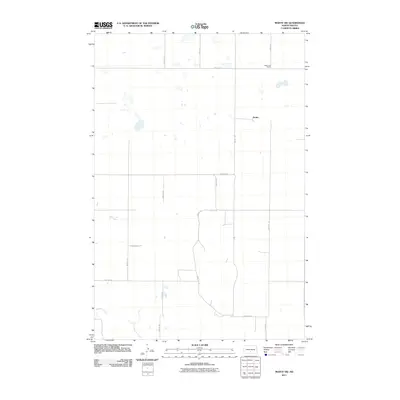
2011 Map of Moffit NW
USGS Topo · Published 2011About this map
Black Leg Ranch and the small settlement of Brittin occupy this portion of the North Dakota prairie, characterized by its systematic section line road network. This landscape in Buchanan Valley Township is largely defined by agriculture and the passage of Glencoe Creek through the southern sections. The survey records a rural grid of secondary roads like Moffit Rd and 249th St SE that facilitate movement between isolated homesteads and ranching operations. Numerous small, ephemeral wetlands and ponds are scattered across the northern half of the quadrangle, illustrating the typical prairie pothole topography of the region. These natural features, alongside arterial routes like 154th Ave SE, provide a look at the modern rural infrastructure used by local families and landowners in the early twenty-first century.
Find a feature on this map
17 named features on this map. Tap any name to fly to it.
Don’t see what you’re looking for? This feature index may not catch every label — zoom into the map to look around manually.
Map Details
Editions of this 2011 Moffit NW Map
This is the sole edition of this map. No revisions or reprints were ever made.
Other maps of this area

1907 · Bismarck
USGS Topo · 1:125,000

1951 · Menoken
USGS Topo · 1:62,500

1951 · McKenzie
USGS Topo · 1:62,500

1954 · Bismarck
USGS Topo · 1:250,000

1958 · Bismarck
USGS Topo · 1:250,000

1971 · Moffit SW
USGS Topo · 1:24,000

1971 · Moffit SE
USGS Topo · 1:24,000

1971 · Fort Rice
USGS Topo · 1:24,000

1971 · Huff NE
USGS Topo · 1:24,000

1971 · Moffit NW
USGS Topo · 1:24,000