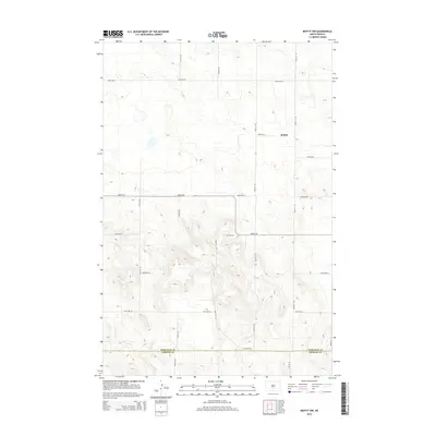
2014 Map of Moffit NW
USGS Topo · Published 2014About this map
The boundary between Burleigh County and Emmons County runs through this landscape of the Missouri Plateau, where the drainage of Glencoe Cr cuts through the southern terrain. This 2014 survey captures the rural character of the region, dominated by a geometric grid of section roads that define the North Dakota prairie. The settlement at Brittin stands as a focal point in the northern portion of the map, situated along a network of routes including 83rd Ave SE and 236th St SE. Further south, Moffit Rd serves as a primary east-west corridor, connecting remote homesteads and agricultural lands. The topography is characterized by subtle glacial depressions and rises typical of the prairie pothole region, with numerous small, unnamed basins scattered across the high plains north of the Emmons County line.
Find a feature on this map
20 named features on this map. Tap any name to fly to it.
Don’t see what you’re looking for? This feature index may not catch every label — zoom into the map to look around manually.
Map Details
Editions of this 2014 Moffit NW Map
This is the sole edition of this map. No revisions or reprints were ever made.
Other maps of this area

1907 · Bismarck
USGS Topo · 1:125,000

1951 · Menoken
USGS Topo · 1:62,500

1951 · McKenzie
USGS Topo · 1:62,500

1954 · Bismarck
USGS Topo · 1:250,000

1958 · Bismarck
USGS Topo · 1:250,000

1971 · Moffit SW
USGS Topo · 1:24,000

1971 · Moffit SE
USGS Topo · 1:24,000

1971 · Fort Rice
USGS Topo · 1:24,000

1971 · Huff NE
USGS Topo · 1:24,000

1971 · Moffit NW
USGS Topo · 1:24,000