2020 Map of Moffit NW
USGS Topo · Published 2020About this map
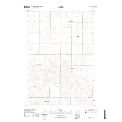
The settlement of Brittin anchors this corner of Burleigh County, situated in a landscape defined by the township boundaries of the Public Land Survey System. The map traces the undulating terrain across the Burleigh Co Emmons Co line, where the prairie is etched by a grid of section-line roads such as Moffit Rd and 102nd Ave SE. This survey reflects the enduring structure of North Dakota’s agricultural plains, where the vast township ranges, including t137n r77w and t138n r77w, dictate the placement of farmsteads and rural infrastructure. Numerous small wetlands and depressions are scattered throughout the northern sections, characteristic of the prairie pothole region. The southern reaches are marked by the transition into t136n r78w, providing a clear look at the topographic contours that define the drainage patterns near the county boundary.
Find a feature on this map
16 named features on this map. Tap any name to fly to it.
Don’t see what you’re looking for? This feature index may not catch every label — zoom into the map to look around manually.
Map Details
Editions of this 2020 Moffit NW Map
This is the sole edition of this map. No revisions or reprints were ever made.
Other maps of this area

1907 · Bismarck
USGS Topo · 1:125,000

1951 · Menoken
USGS Topo · 1:62,500

1951 · McKenzie
USGS Topo · 1:62,500

1954 · Bismarck
USGS Topo · 1:250,000

1958 · Bismarck
USGS Topo · 1:250,000

1971 · Moffit SW
USGS Topo · 1:24,000

1971 · Moffit SE
USGS Topo · 1:24,000

1971 · Fort Rice
USGS Topo · 1:24,000

1971 · Huff NE
USGS Topo · 1:24,000

1971 · Moffit NW
USGS Topo · 1:24,000