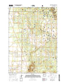
2014 Map of Moffitt Butte
USGS Topo · Published 2014About this map
Moffitt Butte and the surrounding volcanic terrain of Newberry Volcano dominate this landscape within the Deschutes National Forest. Located along the border of Deschutes and Klamath counties, the area is characterized by a network of forest development roads and specialized routes like Moffitt Butte Rd and Nat For Dev Rd 550 that navigate the slopes. In the southwestern portion of the sheet, a residential pattern emerges with a cluster of named roads including Sun Forest Dr, Burlwood Dr, and Larchwood Dr. The Fremont Hwy serves as the primary artery connecting these isolated developments to the broader region. This 2014 survey captures the interface between managed wilderness and rural residential expansion at the edge of the Oregon High Desert.
Find a feature on this map
37 named features on this map. Tap any name to fly to it.
Don’t see what you’re looking for? This feature index may not catch every label — zoom into the map to look around manually.
Map Details
Editions of this 2014 Moffitt Butte Map
This is the sole edition of this map. No revisions or reprints were ever made.
Other maps of this area

1930 · Maiden Peak
USGS Topo · 1:125,000

1931 · Newberry Crater
USGS Topo · 1:125,000

1934 · Maiden Peak
USGS Topo · 1:125,000

1935 · Chemult
USGS Topo · 1:96,000

1935 · Newberry Crater
USGS Topo · 1:125,000

1941 · Chemult
USGS Topo · 1:125,000

1955 · Crescent
USGS Topo · 1:250,000

1957 · Crescent
USGS Topo · 1:250,000

1958 · Crescent
USGS Topo · 1:250,000

1963 · La Pine
USGS Topo · 1:24,000