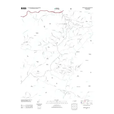
2013 Map of Moffitt Hill
USGS Topo · Published 2013About this map
The Catawba River winds through the northern reaches of this landscape, marking a transition from the river valley to a dense concentration of ridges and knobs. Early 21st-century residential developments and rural settlements like Lackey Town and Moffitt Hill are situated among the intricate drainage networks of Little Crooked Cr and Jordan Br. To the south, the terrain becomes increasingly steep, defined by prominent peaks such as Major Mountain and Wolf Pen Mountain. This area is characterized by numerous gaps and ridges, including Sank Gap and Dutchman Ridge, which have historically dictated the placement of roads like Bartlett Hollow Rd and Cherry Springs Rd. The map also captures several distinct hollows and coves, notably Padgett Cove and Allison Cove, which serve as focal points for local habitation near Davistown. Camp Elliott stands as a notable landmark in the southern interior, situated near the headwaters of Cedar Cr.
Find a feature on this map
179 named features on this map. Tap any name to fly to it.
Don’t see what you’re looking for? This feature index may not catch every label — zoom into the map to look around manually.
Map Details
Editions of this 2013 Moffitt Hill Map
This is the sole edition of this map. No revisions or reprints were ever made.
Other maps of this area

1900 · Mount Mitchell
USGS Topo · 1:125,000

1902 · Mount Mitchell
USGS Topo · 1:125,000

1907 · Saluda
USGS Topo · 1:125,000

1934 · Parts Of Old Fort and Montreat
USGS Topo · 1:24,000

1935 · Montreat
USGS Topo · 1:24,000

1935 · Batcave
USGS Topo · 1:24,000

1935 · Black Mountain
USGS Topo · 1:24,000

1941 · Black Mountain
USGS Topo · 1:24,000
1942 · Montreat
USGS Topo · 1:24,000
1943 · Black Mountain
USGS Topo · 1:24,000