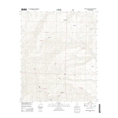
2013 Map of Mogollon Baldy Peak
USGS Topo · Published 2013About this map
Mogollon Baldy Peak dominates this high-elevation landscape within the Gila National Forest, serving as a central point for a complex network of canyons and peaks. The drainage patterns are defined by the West Fork Gila River and several significant tributaries, including Cub Cr and White Cr. This territory is marked by several remote water sources like Little Hobo Spring and Turkeyfeather Spring, which were vital for early travelers and forest rangers. Landform names such as Turkeyfeather Pass, Jackass Park, and Gobbler Canyon reflect the wildlife and pack-animal history of the region. The map provides a detailed view of the high-country terrain before the center of the Mogollon range, highlighting isolated spots like Snow Park and Halfmoon Park that remain significant to backcountry navigation and ecological study.
Find a feature on this map
31 named features on this map. Tap any name to fly to it.
Don’t see what you’re looking for? This feature index may not catch every label — zoom into the map to look around manually.
Map Details
Editions of this 2013 Mogollon Baldy Peak Map
This is the sole edition of this map. No revisions or reprints were ever made.
Other maps of this area

1910 · Mogollon
USGS Topo · 1:125,000

1911 · Alum Mountain
USGS Topo · 1:125,000

1912 · Mogollon
USGS Topo · 1:125,000

1913 · Alum Mountain
USGS Topo · 1:125,000

1954 · Clifton
USGS Topo · 1:250,000

1957 · Clifton
USGS Topo · 1:250,000

1958 · Clifton
USGS Topo · 1:250,000

1962 · Clifton
USGS Topo · 1:250,000

1963 · Bearwallow Mountain
USGS Topo · 1:24,000

1963 · Negrito Mountain
USGS Topo · 1:24,000