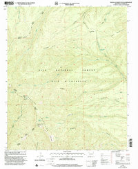
1999 Map of Mogollon Baldy Peak
USGS Topo · Published 2002About this map
Mogollon Baldy Peak Lookout stands as the high-altitude focal point of this mountainous landscape within the Gila Wilderness. The terrain is defined by the significant crests of the Mogollon Mountains and the Jerky Mountains, where high-elevation landmarks like Turkeyfeather Mountain and Cub Mountain overlook a complex network of canyons and parks. Water sources are critical features in this dry mountain environment, with named points such as Black Tail Spring, Little Hobo Spring, and Snow Park Spring providing vital resources along the high ridges.
Find a feature on this map
39 named features on this map. Tap any name to fly to it.
Don’t see what you’re looking for? This feature index may not catch every label — zoom into the map to look around manually.
Map Details
Editions of this 1999 Mogollon Baldy Peak Map
This is the sole edition of this map. No revisions or reprints were ever made.
Other maps of this area

1910 · Mogollon
USGS Topo · 1:125,000

1911 · Alum Mountain
USGS Topo · 1:125,000

1912 · Mogollon
USGS Topo · 1:125,000

1913 · Alum Mountain
USGS Topo · 1:125,000

1954 · Clifton
USGS Topo · 1:250,000

1957 · Clifton
USGS Topo · 1:250,000

1958 · Clifton
USGS Topo · 1:250,000

1962 · Clifton
USGS Topo · 1:250,000

1963 · Bearwallow Mountain
USGS Topo · 1:24,000

1963 · Negrito Mountain
USGS Topo · 1:24,000