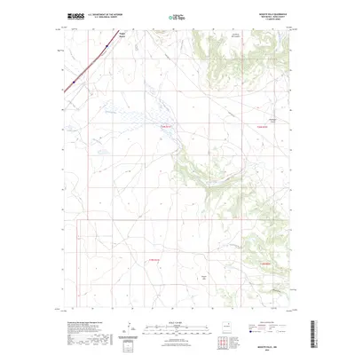
2023 Map of Mogote Hills
USGS Topo · Published 2023About this map
Wagon Mound stands as the primary landmark in this section of Mora County, marking a landscape defined by significant elevation changes and seasonal waterways. The terrain is characterized by dramatic landforms like Las Mesas Del Conjelon and the Mogote Hills, which rise above the surrounding drainage basins. This area is heavily influenced by a network of arroyos and creeks, including Arroyo Jarosa, Vermejo Creek, and Ciruela Creek, illustrating the natural water management patterns of high-desert plains. North of Gallegos Lake, the presence of State Hwy 271 and the Frontage Rd suggests the modernization of historic transit corridors that once skirted these mesas. The inclusion of Bootlegger Canyon offers a hint of the local nomenclature and history found tucked away in the higher elevations.
Find a feature on this map
18 named features on this map. Tap any name to fly to it.
Don’t see what you’re looking for? This feature index may not catch every label — zoom into the map to look around manually.
Map Details
Editions of this 2023 Mogote Hills Map
This is the sole edition of this map. No revisions or reprints were ever made.
Other maps of this area

1892 · Watrous
USGS Topo · 1:125,000

1894 · Watrous
USGS Topo · 1:125,000

1954 · Santa Fe
USGS Topo · 1:250,000

1954 · Raton
USGS Topo · 1:250,000

1958 · Raton
USGS Topo · 1:250,000

1958 · Santa Fe
USGS Topo · 1:250,000

1964 · Wagon Mound
USGS Topo · 1:24,000

1964 · Alto De Hormiga
USGS Topo · 1:24,000

1964 · Frutosa Lake
USGS Topo · 1:24,000

1964 · Mogote Hills
USGS Topo · 1:24,000