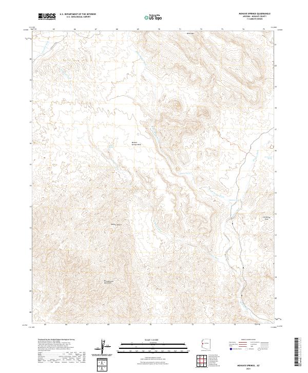
2021 Map of Mohave Springs
USGS Topo · Published 2021About this map
Mohave Springs and the surrounding arid landscape of the Mojave Desert characterize this recent topographical study in Mohave County. The terrain is defined by a series of prominent peaks and drainage systems, including the Bill Williams Mountains to the south and the Castaneda Hills to the east. Water resources in this desert environment are sparse but crucial, marked by features such as Arrowweed Spring and the Mohave Tank. Transportation through the area is limited to rugged routes like Dutch Flat Rd and the 7389H Trl. The map illustrates a complex network of ephemeral waterways, notably the W Mohave Wash and Middle Mohave Wash, which carve through the high ground of Mohave Springs Mesa and the slopes of Black Mtn.
Find a feature on this map
18 named features on this map. Tap any name to fly to it.
Don’t see what you’re looking for? This feature index may not catch every label — zoom into the map to look around manually.
Map Details
Editions of this 2021 Mohave Springs Map
This is the sole edition of this map. No revisions or reprints were ever made.
Other maps of this area

1911 · Parker
USGS Topo · 1:125,000

1923 · Signal
USGS Topo · 1:250,000

1927 · Buck Mountains
USGS Topo · 1:62,500

1929 · Buck Mountains
USGS Topo · 1:62,500

1942 · Signal
USGS Topo · 1:250,000

1943 · Giers Basin
USGS Topo · 1:62,500

1950 · Parker Dam Area
USGS Topo · 1:62,500

1950 · Prescott
USGS Topo · 1:250,000

1954 · Needles
USGS Topo · 1:250,000

1954 · Prescott
USGS Topo · 1:250,000