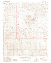
1990 Map of Mohave Springs
USGS Topo · Published 1990About this map
Mohave Springs and the small settlement of Rowland anchor this arid landscape of western Arizona, where life follows the drainage patterns of several major washes. The terrain is defined by the high ground of Mohave Springs Mesa and the nearby Black Mountain, which overlook a network of seasonal watercourses including Dutch Flat Wash and Paloma Wash. The map reveals a history of resource extraction, with scattered Adits and a Prospect indicating mining activity in the southern reaches of the Bill Williams Mountains. Remote 4WD tracks, such as the 4WD Mohave, provide the primary access through the Castaneda Hills, connecting isolated landmarks like a Corral to the wider region. This 1990 provisional edition reflects data from aerial surveys and field checks spanning several decades, documenting the persistent but sparse human presence in this corner of Mohave County.
Find a feature on this map
18 named features on this map. Tap any name to fly to it.
Don’t see what you’re looking for? This feature index may not catch every label — zoom into the map to look around manually.
Map Details
Editions of this 1990 Mohave Springs Map
This is the sole edition of this map. No revisions or reprints were ever made.
Other maps of this area

1911 · Parker
USGS Topo · 1:125,000

1923 · Signal
USGS Topo · 1:250,000

1927 · Buck Mountains
USGS Topo · 1:62,500

1929 · Buck Mountains
USGS Topo · 1:62,500

1942 · Signal
USGS Topo · 1:250,000

1943 · Giers Basin
USGS Topo · 1:62,500

1950 · Parker Dam Area
USGS Topo · 1:62,500

1950 · Prescott
USGS Topo · 1:250,000

1954 · Needles
USGS Topo · 1:250,000

1954 · Prescott
USGS Topo · 1:250,000