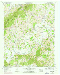
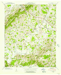
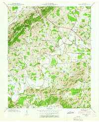
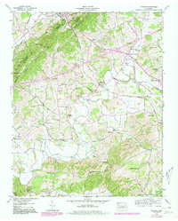
1939 Map of Mohawk
USGS Topo · Published 1973About this map
Bulls Gap serves as a critical geographic pivot on this East Tennessee landscape, where the ridges of Raleigh Mountain and Bent Mountain converge at the intersection of Hawkins, Hamblen, and Greene counties. The Southern Railway dictates the settlement pattern, connecting the rail hub at the gap to the community of Mohawk and further east toward Midway. The lowlands are defined by the winding course of Lick Creek, which supports a dense network of rural infrastructure including Darrow Mill and numerous family-named landmarks. The 1971 photorevisions reveal the evolving agricultural landscape, noted by fine dashed lines representing field boundaries that overlay the original 1939 topography. This map is particularly dense with genealogical sites, from the Wright Cem and Crosby Cem to various rural educational centers like Beech Grove Sch and the Mc Donald Sch, reflecting the decentralized community structure of the mid-20th century.
Find a feature on this map
67 named features on this map. Tap any name to fly to it.
Don’t see what you’re looking for? This feature index may not catch every label — zoom into the map to look around manually.
Map Details
Editions of this 1939 Mohawk Map
4 editions found
Other maps of this area

1883 · Morristown
USGS Topo · 1:125,000

1892 · Greeneville
USGS Topo · 1:125,000

1893 · Morristown
USGS Topo · 1:125,000

1895 · Morristown
USGS Topo · 1:125,000

1896 · Greeneville
USGS Topo · 1:125,000

1904 · Greeneville
USGS Topo · 1:125,000

1935 · Surgoinsville
USGS Topo · 1:48,000

1935 · Rogersville
USGS Topo · 1:48,000

1935 · Parrottsville
USGS Topo · 1:24,000

1935 · McCloud
USGS Topo · 1:24,000