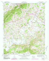
1939 Map of Mohawk
USGS Topo · Published 1980About this map
Bulls Gap serves as a prominent junction point in the northwestern corner of this landscape, where the Southern railroad line threads through the opening between Bays Mountain and Raleigh Mountain. This 1939 Tennessee Valley Authority survey, updated with 1980 photorevisions, documents a transition from the rugged ridges of Hollow Mountain and Taylor Gap down to the fertile agricultural valley of Lick Creek. Evidence of early local industry and community life is scattered throughout the terrain, from the Darrow Mill on Black Creek to rural centers like Warrensburg and Thula. The map preserves the locations of numerous family-named landmarks and rural institutions, including the Drake Cem, Crosby Cem, and several schools like Reeds Sch. The Andrew Johnson Highway cuts across the northern section, connecting the small settlements of Mohawk and Mohawk Crossroad to the wider region.
Find a feature on this map
60 named features on this map. Tap any name to fly to it.
Don’t see what you’re looking for? This feature index may not catch every label — zoom into the map to look around manually.
Map Details
Editions of this 1939 Mohawk Map
4 editions found
Other maps of this area

1883 · Morristown
USGS Topo · 1:125,000

1892 · Greeneville
USGS Topo · 1:125,000

1893 · Morristown
USGS Topo · 1:125,000

1895 · Morristown
USGS Topo · 1:125,000

1896 · Greeneville
USGS Topo · 1:125,000

1904 · Greeneville
USGS Topo · 1:125,000

1935 · Surgoinsville
USGS Topo · 1:48,000

1935 · Rogersville
USGS Topo · 1:48,000

1935 · Parrottsville
USGS Topo · 1:24,000

1935 · McCloud
USGS Topo · 1:24,000