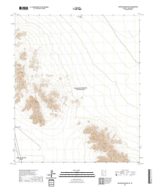
2021 Map of Mohawk Mountains SE
USGS Topo · Published 2021About this map
The Mohawk Mountains rise sharply out of the desert floor, dominating the central and southwestern portions of this Yuma County landscape. This 2021 topographic record reveals a terrain defined by stark elevation changes and dry drainage patterns, where the ephemeral San Cristobal Wash meanders through the broad San Cristobal Valley to the north. A prominent landform known as Gunnery Arch stands in the northwestern reach of the range, likely serving as a distinctive natural landmark for those navigating the arid corridor between the Mohawk Valley and the valley to the east. The map illustrates the classic Basin and Range geography of southwestern Arizona, showing how the mountains segment the desert plains into isolated basins and provide the only significant topographic relief in an otherwise expansive flatland.
Find a feature on this map
11 named features on this map. Tap any name to fly to it.
Don’t see what you’re looking for? This feature index may not catch every label — zoom into the map to look around manually.
Map Details
Editions of this 2021 Mohawk Mountains SE Map
This is the sole edition of this map. No revisions or reprints were ever made.
Other maps of this area

1927 · Aguila Mountains
USGS Topo · 1:48,000

1927 · Kim
USGS Topo · 1:62,500

1930 · Aguila Mountains
USGS Topo · 1:62,500

1931 · Kim
USGS Topo · 1:62,500

1953 · Ajo
USGS Topo · 1:250,000

1957 · Ajo
USGS Topo · 1:250,000

1958 · Ajo
USGS Topo · 1:250,000

1962 · Ajo
USGS Topo · 1:250,000

1963 · Ajo
USGS Topo · 1:250,000
1965 · Mohawk Mts NW
USGS Topo · 1:24,000