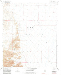
1965 Map of Mohawk SW
USGS Topo · Published 1984About this map
Copper Mountains rise sharply along the western edge of this desert landscape, where mining activity once defined the local economy during the mid-20th century. The presence of the Betty Lee Mine and several other unnamed Mines tucked into the mountain draws indicates a period of prospecting and resource extraction in this remote corner of Yuma County. These sites are linked by a network of Jeep Trails and Jeep Trs that traverse the arid flats towards the Mohawk Valley.
Find a feature on this map
10 named features on this map. Tap any name to fly to it.
Don’t see what you’re looking for? This feature index may not catch every label — zoom into the map to look around manually.
Map Details
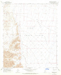
Editions of this 1965 Mohawk SW Map
2 editions found
Other maps of this area

1926 · Wellton
USGS Topo · 1:62,500

1926 · Mohawk
USGS Topo · 1:62,500

1928 · Mohawk
USGS Topo · 1:62,500

1929 · Wellton
USGS Topo · 1:62,500

1942 · Yuma
USGS Topo · 1:250,000

1953 · Ajo
USGS Topo · 1:250,000

1954 · El Centro
USGS Topo · 1:250,000

1955 · El Centro
USGS Topo · 1:250,000

1957 · Ajo
USGS Topo · 1:250,000

1958 · Ajo
USGS Topo · 1:250,000