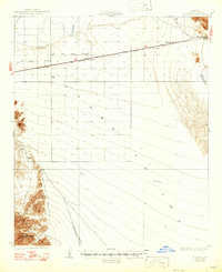
1928 Map of Mohawk
USGS Topo · Published 1947About this map
The Southern Pacific railroad corridor defines this desert landscape, running parallel to the Gila River through the heart of the Mohawk Valley. In the late 1920s, this area was a critical transit and utility artery, evidenced by the infrastructure of the Gas and Water Company and Gila Valley Electric. Small railroad-oriented settlements like Colfred, Pembroke, and Gael punctuate the rail line, while the Mohawk Inn serves as a lone landmark along the highway. To the south, the terrain rises sharply into the Copper Mountains, where the Arizona Consolidated Mining Co operation sits near the edge of the range. This survey captures a moment when desert survival and industrial progress relied on a narrow band of water and iron, stretching from the river to the remote Papago Well.
Find a feature on this map
16 named features on this map. Tap any name to fly to it.
Don’t see what you’re looking for? This feature index may not catch every label — zoom into the map to look around manually.
Map Details
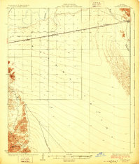
Editions of this 1928 Mohawk Map
3 editions found
Other maps of this area

1926 · Wellton
USGS Topo · 1:62,500

1926 · Mohawk
USGS Topo · 1:62,500

1927 · Kim
USGS Topo · 1:62,500

1928 · Mohawk
USGS Topo · 1:62,500

1928 · Norton
USGS Topo · 1:62,500

1929 · Wellton
USGS Topo · 1:62,500

1929 · Norton
USGS Topo · 1:62,500

1930 · Stoval
USGS Topo · 1:62,500

1931 · Kim
USGS Topo · 1:62,500

1942 · Yuma
USGS Topo · 1:250,000