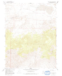
1967 Map of Moho Mountain
USGS Topo · Published 1991About this map
Mining operations and ancient sites dot this 1967 survey of Mineral County, primarily concentrated within the southern reaches of the Excelsior Mountains. The area around Silver Gulch Mine and Black Hawk Mine reveals a landscape heavily shaped by prospectors, while the Marietta Mines sit at the southern edge of the sheet. Archaeological interests are represented by Petroglyphs located near Rattlesnake Flat, indicating a long history of human presence in this high-desert environment.
Find a feature on this map
21 named features on this map. Tap any name to fly to it.
Don’t see what you’re looking for? This feature index may not catch every label — zoom into the map to look around manually.
Map Details
Editions of this 1967 Moho Mountain Map
3 editions found
Other maps of this area

1909 · Hawthorne
USGS Topo · 1:250,000

1911 · Hawthorne
USGS Topo · 1:250,000

1915 · Hawthorne
USGS Topo · 1:250,000

1948 · Walker Lake
USGS Topo · 1:250,000

1957 · Walker Lake
USGS Topo · 1:250,000

1962 · Walker Lake
USGS Topo · 1:250,000

1964 · Walker Lake
USGS Topo · 1:250,000

1967 · Pamlico
USGS Topo · 1:24,000

1967 · Moho Mountain
USGS Topo · 1:24,000

1967 · Mina NW
USGS Topo · 1:24,000