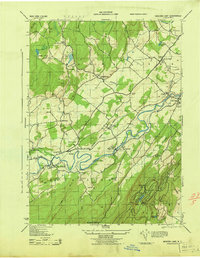
1943 Map of Mohonk Lake
USGS Topo · Published 1943About this map
The Shawangunk Mountains define the southern landscape of this 1943 survey, rising above the famous Mohonk House and the waters of Mohonk Lake. The area's mid-century transportation and settlement patterns are clearly visible, anchored by the New York Ontario and Western railroad as it follows the path of Rondout Creek. Communities like High Falls and Kyserike are shown with their respective depots, including the High Falls RR Station, serving as vital links for local commerce and travel.
Find a feature on this map
60 named features on this map. Tap any name to fly to it.
Don’t see what you’re looking for? This feature index may not catch every label — zoom into the map to look around manually.
Map Details
Editions of this 1943 Mohonk Lake Map
This is the sole edition of this map. No revisions or reprints were ever made.
Other maps of this area

1901 · Rosendale
USGS Topo · 1:62,500

1903 · Newburg
USGS Topo · 1:62,500

1903 · Rosendale
USGS Topo · 1:62,500

1903 · Slide Mountain
USGS Topo · 1:62,500

1904 · Ellenville
USGS Topo · 1:62,500

1905 · Slide Mountain
USGS Topo · 1:62,500

1906 · Ellenville
USGS Topo · 1:62,500
1942 · Kingston West
USGS Topo · 1:24,000
1942 · Rosendale
USGS Topo · 1:24,000

1942 · West Shokan
USGS Topo · 1:24,000