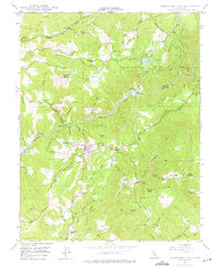
1948 Map of Mokelumne Hill
USGS Topo · Published 1975About this map
Mokelumne Hill serves as the central hub of this 1940s landscape, where the Sierra foothills are defined by a complex network of water management and early mining remnants. The Mokelumne River carves through the center of the sheet, supported by significant infrastructure including Lake Tabeaud and the Powerhouse at Electra. This era shows a landscape transitioned from the height of the Gold Rush toward industrial hydroelectric power and ranching, though the ghosts of the earlier era remain visible at the (Butte City) Ruins.
Find a feature on this map
59 named features on this map. Tap any name to fly to it.
Don’t see what you’re looking for? This feature index may not catch every label — zoom into the map to look around manually.
Map Details
Editions of this 1948 Mokelumne Hill Map
4 editions found
Other maps of this area

1889 · Jackson
USGS Topo · 1:125,000

1892 · Jackson
USGS Topo · 1:125,000

1897 · Jackson
USGS Topo · 1:125,000

1902 · Jackson
USGS Topo · 1:125,000

1941 · Sutter Creek
USGS Topo · 1:62,500

1944 · Valley Springs
USGS Topo · 1:62,500

1944 · Sutter Creek
USGS Topo · 1:62,500

1945 · San Andreas
USGS Topo · 1:62,500

1947 · San Andreas
USGS Topo · 1:62,500

1947 · Sacramento
USGS Topo · 1:250,000