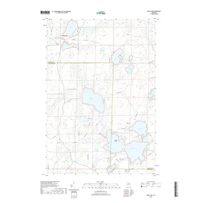
2018 Map of Mole Lake
USGS Topo · Published 2018About this map
Mole Lake serves as the focal point of this northern Wisconsin landscape, where the Sokaogon Chippewa Community is centered near the shores of Rice Lake and the winding course of Swamp Creek. The geography is defined by a dense concentration of glacial water bodies, ranging from the expansive Rolling Stone Lake to the intricate shorelines of Pickerel Lake and Crane Lake. This 2018 survey reveals a network of local roads and community landmarks such as Community Dr and Sokoagon Dr, reflecting the modern infrastructure of the reservation and surrounding Forest and Langlade counties.
Find a feature on this map
73 named features on this map. Tap any name to fly to it.
Don’t see what you’re looking for? This feature index may not catch every label — zoom into the map to look around manually.
Map Details
Editions of this 2018 Mole Lake Map
This is the sole edition of this map. No revisions or reprints were ever made.
Other maps of this area

1939 · Crandon
USGS Topo · 1:48,000

1940 · Monico
USGS Topo · 1:48,000

1941 · Crandon
USGS Topo · 1:48,000

1942 · Elcho
USGS Topo · 1:48,000

1942 · Pearson
USGS Topo · 1:48,000

1947 · Crandon
USGS Topo · 1:48,000

1950 · Monico
USGS Topo · 1:48,000

1950 · Elcho
USGS Topo · 1:48,000

1950 · Lily
USGS Topo · 1:48,000

1954 · Iron Mountain
USGS Topo · 1:250,000