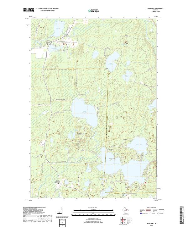
2022 Map of Mole Lake
USGS Topo · Published 2022About this map
Mole Lake tribal lands and the surrounding lake country of northern Wisconsin define this landscape near the boundary of Forest and Langlade Counties. The settlement of Mole Lake sits along Swamp Creek, adjacent to the Mole Lake Tribal Cem and the waters of Rice Lake. This region is characterized by a dense network of glacial water bodies, including the large Rolling Stone Lake, Crane Lake, and Pickerel Lake, which features the prominent Woods Island. Local heritage is anchored by sites like the Arbutus Lutheran Church and Arbutus Cem near Deadman Lake. The geography is interlaced with recreational and transit corridors such as the Wolf River State Trl and various seasonal routes like the Snowmobile Trl, reflecting the area's long-standing connection to both indigenous history and the timber-rich Northwoods environment.
Find a feature on this map
81 named features on this map. Tap any name to fly to it.
Don’t see what you’re looking for? This feature index may not catch every label — zoom into the map to look around manually.
Map Details
Editions of this 2022 Mole Lake Map
This is the sole edition of this map. No revisions or reprints were ever made.
Other maps of this area

1939 · Crandon
USGS Topo · 1:48,000

1940 · Monico
USGS Topo · 1:48,000

1941 · Crandon
USGS Topo · 1:48,000

1942 · Elcho
USGS Topo · 1:48,000

1942 · Pearson
USGS Topo · 1:48,000

1947 · Crandon
USGS Topo · 1:48,000

1950 · Monico
USGS Topo · 1:48,000

1950 · Elcho
USGS Topo · 1:48,000

1950 · Lily
USGS Topo · 1:48,000

1954 · Iron Mountain
USGS Topo · 1:250,000