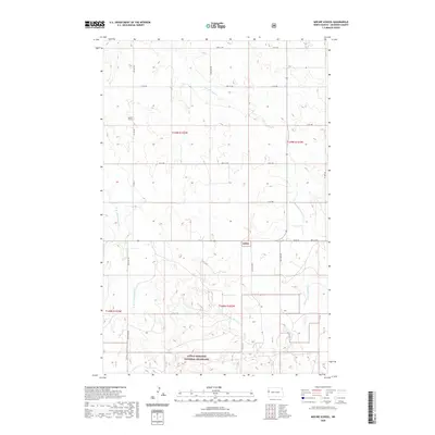
2020 Map of Moline School
USGS Topo · Published 2020About this map
Moline School stands as a focal point in this portion of rural McKenzie County, where the plains of western North Dakota meet the edges of the Little Missouri National Grassland. The landscape is defined by the winding drainage of Charbonneau Cr and its western branch, W Br Charbonneau Cr, alongside Spring Cr. These watercourses carve through the undulating terrain, dictating the placement of the section-line road network. The map reveals the precise township and range organization of the High Plains, with a systematic grid of routes like 16th St NW and Co Rd 30 providing access to isolated homesteads and public lands. This 2020 survey documents the modern state of these remote ranching and grazing lands, preserving the locations of rural school sites and public boundary lines established long ago.
Find a feature on this map
21 named features on this map. Tap any name to fly to it.
Don’t see what you’re looking for? This feature index may not catch every label — zoom into the map to look around manually.
Map Details
Editions of this 2020 Moline School Map
This is the sole edition of this map. No revisions or reprints were ever made.
Other maps of this area

1953 · Watford City
USGS Topo · 1:250,000

1957 · Watford City
USGS Topo · 1:250,000

1967 · Watford City
USGS Topo · 1:250,000

1972 · Bear Butte
USGS Topo · 1:24,000

1972 · Alexander
USGS Topo · 1:24,000

1972 · Moline School
USGS Topo · 1:24,000

1972 · Rawson
USGS Topo · 1:24,000

1972 · Charbonneau
USGS Topo · 1:24,000

1972 · Sheep Creek
USGS Topo · 1:24,000

1972 · Sather Lake
USGS Topo · 1:24,000