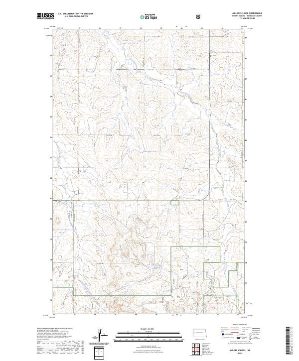
2024 Map of Moline School
USGS Topo · Published 2024About this map
Charbonneau Creek and its tributary, the West Branch Charbonneau Creek, carve a drainage network through this portion of McKenzie County, defining the local topography. This 2024 survey documents the section lines and rural road infrastructure that organize the agricultural landscape, including routes such as Co Rd 15 and Co Rd 30. The land is meticulously partitioned by township and range boundaries like t149n r102w and t148n r102w, reflecting the enduring Public Land Survey System. Further south, Spring Creek flows through the prairie, highlighting the essential role of water sources in this semi-arid environment. The map captures the current state of a region where modern grid-based navigation, via numbered roads like 150th Ave NW, overlays the natural curves of the creek beds.
Find a feature on this map
23 named features on this map. Tap any name to fly to it.
Don’t see what you’re looking for? This feature index may not catch every label — zoom into the map to look around manually.
Map Details
Editions of this 2024 Moline School Map
This is the sole edition of this map. No revisions or reprints were ever made.
Other maps of this area

1953 · Watford City
USGS Topo · 1:250,000

1957 · Watford City
USGS Topo · 1:250,000

1967 · Watford City
USGS Topo · 1:250,000

1972 · Bear Butte
USGS Topo · 1:24,000

1972 · Alexander
USGS Topo · 1:24,000

1972 · Moline School
USGS Topo · 1:24,000

1972 · Rawson
USGS Topo · 1:24,000

1972 · Charbonneau
USGS Topo · 1:24,000

1972 · Sheep Creek
USGS Topo · 1:24,000

1972 · Sather Lake
USGS Topo · 1:24,000