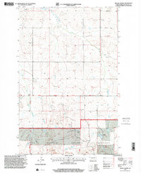
1997 Map of Moline School
USGS Topo · Published 2001About this map
Charbonneau Creek and Antelope Creek define this landscape in rural North Dakota, where the late twentieth-century economy is shaped by the cattle ranching of the Little Missouri National Grassland and the energy production at the Box Car Butte Oil Field. The presence of the Moline School (Site) near the western margin provides a locational anchor for a former rural community center, while the Highland Ch stands south along the Twelfth Standard Parallel North. Family ranching persists at locations such as the P Nygard Ranch near the southern boundary. Topography is dominated by distinct formations like Box Car Butte, which sits in a transition between the drainage of the West Branch Charbonneau Creek and the broader grazing lands. The map also documents industrial infrastructure, including an extensive Pipeline and various oil wells scattered throughout the central and eastern sections.
Find a feature on this map
19 named features on this map. Tap any name to fly to it.
Don’t see what you’re looking for? This feature index may not catch every label — zoom into the map to look around manually.
Map Details
Editions of this 1997 Moline School Map
This is the sole edition of this map. No revisions or reprints were ever made.
Other maps of this area

1953 · Watford City
USGS Topo · 1:250,000

1957 · Watford City
USGS Topo · 1:250,000

1967 · Watford City
USGS Topo · 1:250,000

1972 · Bear Butte
USGS Topo · 1:24,000

1972 · Alexander
USGS Topo · 1:24,000

1972 · Moline School
USGS Topo · 1:24,000

1972 · Rawson
USGS Topo · 1:24,000

1972 · Charbonneau
USGS Topo · 1:24,000

1972 · Sheep Creek
USGS Topo · 1:24,000

1972 · Sather Lake
USGS Topo · 1:24,000