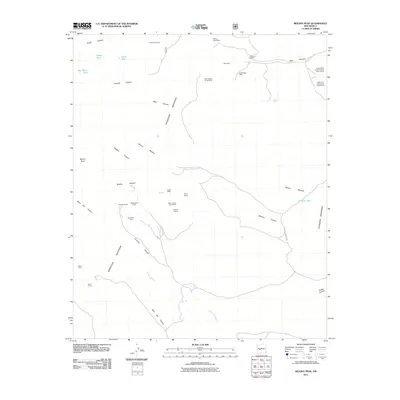
2011 Map of Molino Peak
USGS Topo · Published 2011About this map
Magdalena Mountains and the eastern slopes of the Chupadera Mountains define this high-desert landscape in Socorro County. The area is heavily marked by its mineral history, particularly within the Luis Lopez District, where claims like the Geronimo Claims-Luis Lopez District and Manganese Chief reflect decades of extraction. Deep canyons such as Bear Canyon and Madera Canyon cut through the terrain, leading toward the Torreon Arroyo. This survey provides a precise look at modern land use, showing isolated cattle tanks like Gay Water Tank and Broken Tank alongside the small outpost at Gianero Ranch. The presence of the Black Eagle Mine and the Phillips Lease Mine highlights the persistent interest in the geological resources of Molino Peak and its surrounding ridges.
Find a feature on this map
34 named features on this map. Tap any name to fly to it.
Don’t see what you’re looking for? This feature index may not catch every label — zoom into the map to look around manually.
Map Details
Editions of this 2011 Molino Peak Map
This is the sole edition of this map. No revisions or reprints were ever made.
Other maps of this area

1906 · Socorro
USGS Topo · 1:62,500

1916 · La Joya
USGS Topo · 1:125,000

1948 · San Antonio
USGS Topo · 1:62,500

1954 · Tularosa
USGS Topo · 1:250,000

1954 · Socorro
USGS Topo · 1:250,000

1958 · Socorro
USGS Topo · 1:250,000

1958 · Tularosa
USGS Topo · 1:250,000

1959 · Socorro
USGS Topo · 1:24,000

1959 · Magdalena
USGS Topo · 1:62,500

1959 · Socorro
USGS Topo · 1:62,500