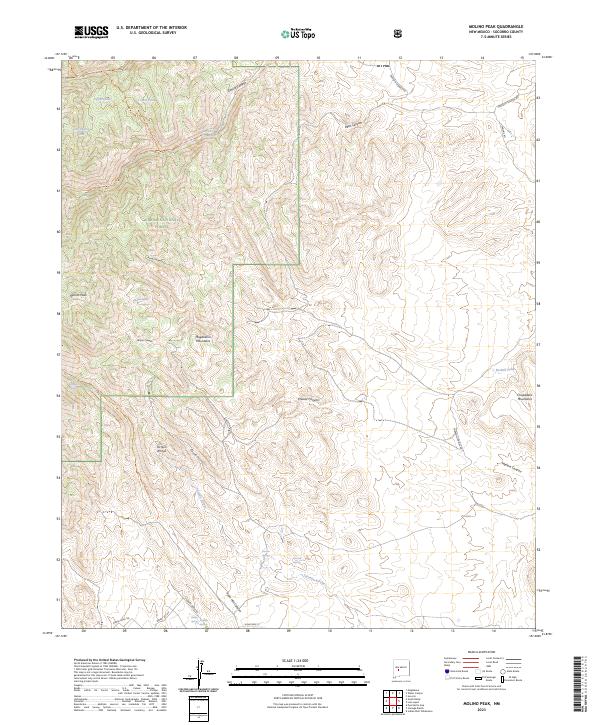
2023 Map of Molino Peak
USGS Topo · Published 2023About this map
The Magdalena Mountains dominate this high-desert landscape in Socorro County, where steep drainages like Molino Canyon and Chavez Canyon cut through the rugged slopes of the Cibola National Forest. This modern 2023 survey documents a network of primitive trails and springs essential to this arid environment, including Molino Spring, Torreon Springs, and Box Spring. To the east, the Chupadera Mountains rise above the alluvial fans of Torreon Arroyo and Madera Canyon. The map reveals the intricate access required for this terrain, noting the Deadhorse Trl and Ryan Hill Trl that wind through the peaks. In the south, residential development begins to appear along the forest boundary with names like Granite Ridge Rd and Sunnyside Ct near the Cienega Spring.
Find a feature on this map
39 named features on this map. Tap any name to fly to it.
Don’t see what you’re looking for? This feature index may not catch every label — zoom into the map to look around manually.
Map Details
Editions of this 2023 Molino Peak Map
This is the sole edition of this map. No revisions or reprints were ever made.
Other maps of this area

1906 · Socorro
USGS Topo · 1:62,500

1916 · La Joya
USGS Topo · 1:125,000

1948 · San Antonio
USGS Topo · 1:62,500

1954 · Tularosa
USGS Topo · 1:250,000

1954 · Socorro
USGS Topo · 1:250,000

1958 · Socorro
USGS Topo · 1:250,000

1958 · Tularosa
USGS Topo · 1:250,000

1959 · Socorro
USGS Topo · 1:24,000

1959 · Magdalena
USGS Topo · 1:62,500

1959 · Socorro
USGS Topo · 1:62,500