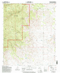
1995 Map of Molino Peak
USGS Topo · Published 1998About this map
Magdalena Mountains and the northern reaches of the Chupadera Mountains dominate this high-desert landscape in Socorro County. The area is defined by a legacy of resource extraction, with numerous Prospects and a Strip Mine dotting the drainages of Molino Canyon and Madera Canyon. Water remains the most critical resource in this arid environment, evidenced by a dense network of naming conventions for essential sources such as Sixmile Spring, Torreon Springs, and Gay Water Tank.
Find a feature on this map
44 named features on this map. Tap any name to fly to it.
Don’t see what you’re looking for? This feature index may not catch every label — zoom into the map to look around manually.
Map Details
Editions of this 1995 Molino Peak Map
This is the sole edition of this map. No revisions or reprints were ever made.
Other maps of this area

1906 · Socorro
USGS Topo · 1:62,500

1916 · La Joya
USGS Topo · 1:125,000

1948 · San Antonio
USGS Topo · 1:62,500

1954 · Tularosa
USGS Topo · 1:250,000

1954 · Socorro
USGS Topo · 1:250,000

1958 · Socorro
USGS Topo · 1:250,000

1958 · Tularosa
USGS Topo · 1:250,000

1959 · Socorro
USGS Topo · 1:24,000

1959 · Magdalena
USGS Topo · 1:62,500

1959 · Socorro
USGS Topo · 1:62,500