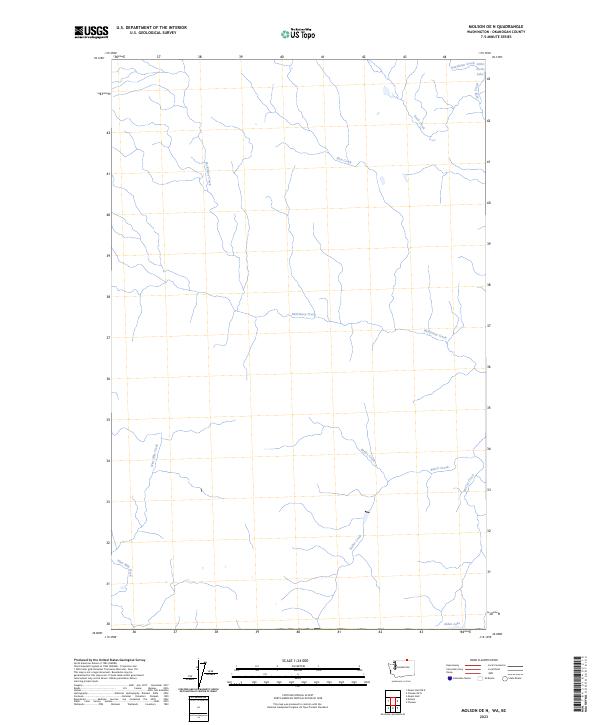
2023 Map of Molson OE N
USGS Topo · Published 2023About this map
McKinney Creek dominates the drainage patterns of this upland terrain in Okanogan County, carving a long path across the landscape before meeting other tributaries. The area is defined by its complex network of seasonal and perennial waterways that move through the high country just south of the international border. In the northern reaches, small bodies of water like Little Fresh Lake and the headwaters of Stanhope Creek provide important landmarks for the local ecology. To the south, Alden Lake sits as a notable geographic marker, while the drainages of Nine Mile Creek and Baker Creek illustrate the natural descent of the watershed. This contemporary survey by the U.S. Geological Survey utilizes hydrography data to trace the precise flow of these creeks as they weave through private and public lands.
Find a feature on this map
11 named features on this map. Tap any name to fly to it.
Don’t see what you’re looking for? This feature index may not catch every label — zoom into the map to look around manually.
Map Details
Editions of this 2023 Molson OE N Map
This is the sole edition of this map. No revisions or reprints were ever made.
Other maps of this area

1902 · Osoyoos
USGS Topo · 1:125,000

1904 · Osoyoos
USGS Topo · 1:125,000

1954 · Okanogan
USGS Topo · 1:250,000

1957 · Mt. Bonaparte
USGS Topo · 1:62,500

1957 · Oroville
USGS Topo · 1:62,500

1958 · Okanogan
USGS Topo · 1:250,000

1981 · Mount Hull
USGS Topo · 1:24,000

1984 · Oroville
USGS Topo · 1:100,000
1988 · Chesaw
USGS Topo · 1:24,000
1988 · Molson
USGS Topo · 1:24,000