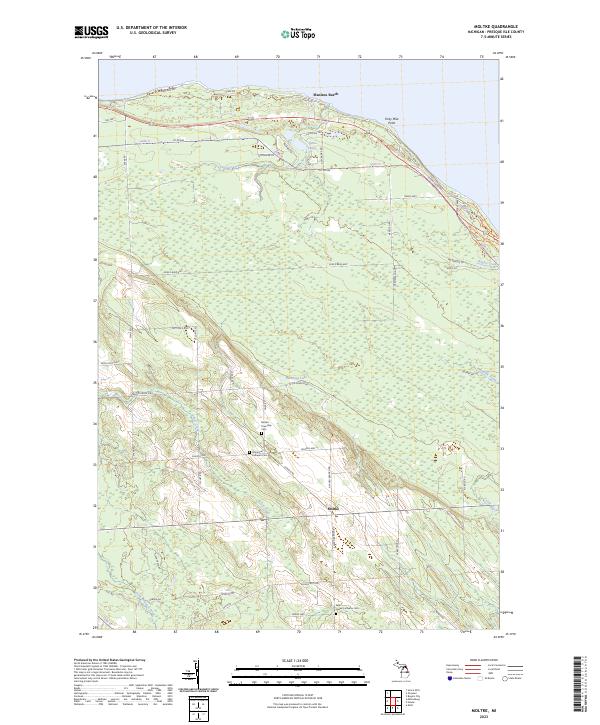
2023 Map of Moltke
USGS Topo · Published 2023About this map
Forty Mile Point stands as a prominent landmark on the Lake Huron shoreline, marking a transition from the coastal waters to the agrarian interior of Presque Isle County. This northern Michigan landscape is defined by its deep-rooted Lutheran heritage, evidenced by the clustered presence of the Molke Township Cem, Immanuel Lutheran Cem, and Saint James Lutheran Cem. These sites serve as central points for the small settlement of Moltke, where the road network follows section lines through a mix of wooded tracts and wetlands.
Find a feature on this map
63 named features on this map. Tap any name to fly to it.
Don’t see what you’re looking for? This feature index may not catch every label — zoom into the map to look around manually.
Map Details
Editions of this 2023 Moltke Map
This is the sole edition of this map. No revisions or reprints were ever made.
Other maps of this area

1954 · Alpena
USGS Topo · 1:250,000

1955 · Cheboygan
USGS Topo · 1:250,000

1957 · Alpena
USGS Topo · 1:250,000

1957 · Onaway
USGS Topo · 1:62,500

1958 · Cheboygan
USGS Topo · 1:250,000

1958 · Alpena
USGS Topo · 1:250,000

1958 · Grace
USGS Topo · 1:62,500

1969 · Alpena
USGS Topo · 1:250,000

1971 · Rogers City
USGS Topo · 1:24,000

1971 · Hawks
USGS Topo · 1:24,000